


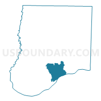
Mokane Voting District, Callaway County, Missouri
About
Outline

Summary
| Unique Area Identifier | 607315 |
| Name | Mokane Voting District |
| County | Callaway County |
| State | Missouri |
| Area (square miles) | 33.28 |
| Land Area (square miles) | 32.51 |
| Water Area (square miles) | 0.77 |
| % of Land Area | 97.68 |
| % of Water Area | 2.32 |
| Latitude of the Internal Point | 38.70563520 |
| Longtitude of the Internal Point | -91.89126720 |
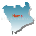
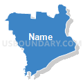
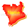
Maps


Graphs
Select a template below for downloading or customizing gragh for Mokane Voting District, Callaway County, Missouri


Neighbors
Neighoring Voting District (by Name) Neighboring Voting District on the Map
- Chamois Voting District, Osage County, MO
- Dixie Voting District, Callaway County, MO
- Frankenstein Voting District, Osage County, MO
- Hams Prairie Voting District, Callaway County, MO
- Portland Voting District, Callaway County, MO
- Readsville Voting District, Callaway County, MO
- Tebbetts Voting District, Callaway County, MO
Top 10 Neighboring County Subdivision (by Population) Neighboring County Subdivision on the Map
- Linn township, Osage County, MO (2,202)
- St. Aubert township, Callaway County, MO (1,969)
- Benton township, Osage County, MO (1,172)
- Cote Sans Dessein township, Callaway County, MO (1,122)
- Auxvasse township, Callaway County, MO (1,000)
- Caldwell township, Callaway County, MO (438)
Top 10 Neighboring Place (by Population) Neighboring Place on the Map
Top 10 Neighboring Unified School District (by Population) Neighboring Unified School District on the Map
- Jefferson City Public Schools, MO (71,991)
- South Callaway R-II Schools, MO (4,457)
- Osage County R-I School District, MO (1,156)
Top 10 Neighboring State Legislative District Lower Chamber (by Population) Neighboring State Legislative District Lower Chamber on the Map
Top 10 Neighboring State Legislative District Upper Chamber (by Population) Neighboring State Legislative District Upper Chamber on the Map
Top 10 Neighboring 111th Congressional District (by Population) Neighboring 111th Congressional District on the Map
Top 10 Neighboring Census Tract (by Population) Neighboring Census Tract on the Map
- Census Tract 706, Callaway County, MO (6,426)
- Census Tract 707, Callaway County, MO (6,294)
- Census Tract 702, Callaway County, MO (3,633)
- Census Tract 4901, Osage County, MO (3,381)
Top 10 Neighboring 5-Digit ZIP Code Tabulation Area (by Population) Neighboring 5-Digit ZIP Code Tabulation Area on the Map
- 65251, MO (22,437)
- 65063, MO (3,412)
- 65024, MO (1,086)
- 65080, MO (1,015)
- 65059, MO (867)
- 65077, MO (561)